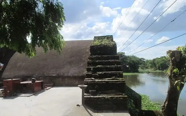
Brahmanbaria Tourist Spots are Hatir Pool, Anderson Memorial, and much more. Brahmanbaria (ব্রাহ্মণবাড়িয়া) is also known as Bbaria.
About Brahmanbaria
The district is in the east-central of Bangladesh. It means the place where Brahmins reside. Bbaria is a part of the Chittagong Division. It was part of the greater Comilla District until 1984. At first, Isa Khan built his capital at Sarail which is 10 km north of Bbaria Town. The area was a part of Samatat state. Later it was included in the Tripura district in 1790. Currently, Brahman-Baria was announced as a district on 15 Feb 1984. During the Mughal era, Brahmanbaria was famous for producing quality cloth Muslin. There are many interesting tourist places to visit.
Upazilas and Thanas
- Akhaura
- Ashuganj
- Bancharampur
- Bijoynagar
- Brahmanbaria Sadar
- Kasba
- Nabinagar
- Nasirnagar
- Sarail
Border and bounded By
- Kishoreganj District and Habiganj District on the north
- Comilla District on the south
- Habiganj District and Tripura State, India on the east
- Narayanganj District on the west.
Weather / Temperature
- Highest average temperature: 34.3°c Celsius
- The lowest average temperature: is 12.7°c Celsius.
- The average amount of rainfall: 2551 mm.
Brahmanbaria Tourist Spots
Brahmanbaria has 9 Upazalias. There are many historical and archaeological illustrations in here.
-
Brahmanbaria Sadar
- Anderson Memorial (Kautali)
- Ulchapara Jami Mosque
- Brahmanbaria Archives and Museum
- Bhadurghar Shahi Mosque (1084 AH)
- Kal Bhairab Mandir
- Anandamayee Kali Mandir
- Sree Sree Shiva Mandir
- Nreesingha Joar Mandir
- Mourail Kali Mandir
- Haraspur Zamindar Bari
- Hammamkhana
- Hatir Pool (elephant bridge) at Baraiura
-
Kasba Upazila
- Sree Sree Anandamoye Ashram (seventeenth century)
- Kailaghar Jangal
- Kuti Bara Masjid
- Moinpur Mosque (eighteenth century)
- Three domed Mosque at Araibari
- Kalibari Mandir (Kheora, seventeenth century)
-
Sarail
- Arphail Sagardighi Mosque and
- Twin Graves (sixteenth century, Sarail)
- Arphannesa Mosque (1662, Sarail)
- Hatkhola Jami Mosque (seventeenth century)
- Sarail Shahi Jami Mosque (Mughal period)
- Sagardighi Mosque at Ariphail (sixteenth century)
- Twin Grave (under the care of the National Museum)
- Hatir Pool Jami Mosque at Bariura (Mughal period)
- Well at Hablipara (Mughal period)
- Nabinagar Upazila
- Shahpur Mosque (1876)
- Munsef Adalat (1884)
- Dakshin Para Mosque (Ahammadpur)
- Satidaha memorial Mandir at Biddyakot
- Nabinagar Math
- Abandoned Zamindar Bari
- Kameni Bala Debi Ananda Asrama
- Natghar Shiva Statue (seventeenth century)
- Sarvadharma Samanya Mandir (Kalikachha)
- Kosti Pathar Basudeva Statue (seventeenth century, Baghaura)
- Kosti Pathar Bishnu Statue (seventeenth century, Satmura)
- Jagannath Mandir
-
Akhaura Upazila
- Mazar of Kalla Shaheed (R) at Kharampur
- Chhatura Sharif Bara Mosque
- Mathkhola at Mogra
- Kachhari (revenue office) of Maharaj
-
Banchharampur Upazila
- Khoshkandi Jami Mosque
- Banchharampur Sadar Jami Mosque
- Dhariar Char Jami Mosque
- Ujan Char Kali Mandir
- Ropusdi Dakshin Bazar Kali Mandir
- Others
- Ashuganj Tahsil Office (1904)
- Buddhist Viharas (Devgram)
- Gangasagar Dighi
- Shiva Mandir (Natghar),
Transportation and Communication
The road distance is 103 km from Dhaka. Rail, train, and bus are the primary transportation to reach Brahmanbaria. Brahmanbaria Sadar And Akhuara are the main railway junctions. Kamlapur is the main terminal in Dhaka. Buses are also available. Most of the bus stops are Gulisthan and Jatrabari. No airline communication is here.
District Information
|
Main River |
Meghna River, the Titas River, Buri, and Haora |
Division |
Chittagong Division |
Country |
Bangladesh |
Nearest Airport |
Sylhet |
Postal Code |
3400 |
NWD Code |
0851 |
ISD Code |
0088 |
Currency |
Taka (BDT) |
BD Govt. Official Website |
www.brahmanbaria.gov.bd |
Related Web Links